08 Dec 2025 - {{hitsCtrl.values.hits}}
By Shane Seneviratne
Former Head of the Department of Geology of Peradeniya Univeresity Senior Prof. Athula Senaratne said a cartographying of endangered areas in 14 districts would commence within a fortnight.
He said slopes of more than 45degrees gradient are vulnerable to landslides but an area between 20-30 degrees gradient could be subject to landslide in case of unusually high rainfall.
Prof. Senaratne said the cartographying would be carried out in eight districts vulnerable to landslide and six districts bordering them. He said the programme would be implemented by the National Building and Research Organisation, and the Faculties of Geology of universities..
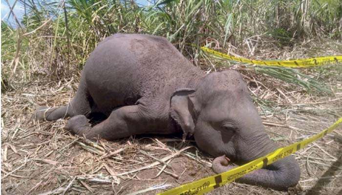
He pointed out that the locations affected by landslides during the present disaster had been identified earlier and red notices issued on them. He said in case of a heavy rain between 400 and 500 mtrs slopes of lesser gradient could be subject to the danger of landslides.
He said the NBRO had recommended resettlement of people in the endangered areas, in safer locations but it had been unheeded due to want of land.
Prof. Senaratne pointed out that the upcountry railway beyond Rambukkana is more than 150 years old and a thorough inspection of it should be carried out. He warned the people living in endangered areas to be cautious if the floor near their houses developed cracks or caving and to leave for safer locations during heavy rain.
23 Jun 2026 3 hours ago
23 Jun 2026 3 hours ago
23 Jun 2026 3 hours ago
23 Jun 2026 4 hours ago
23 Jun 2026 4 hours ago