Reply To:
Name - Reply Comment
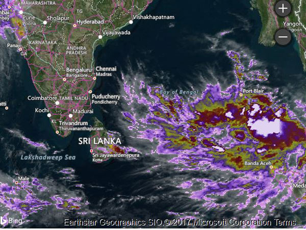
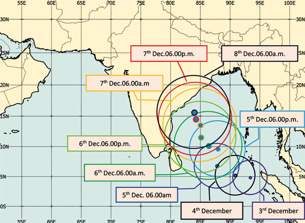
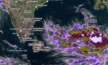 The low pressure area South-East of the Bay of Bengal was located nearly 1300km from Sri Lanka by this evening.
The Meteorology Department warns of showers exceeding 75 mm particularly in the Northern, North-Central and Eastern and Uva Provinces and thundershowers in other areas with winds of up to 60 kmph particularly in the Northern and Southern and Eastern Provinces from tomorrow to Friday.
It said winds of up to 80 kmph could be expected over the sea areas off the Island while the districts of Mullaitivu, Kilinochchi, Jaffna, Vavuniya, Batticaloa and Trincomallee and Sabaragamuwa and the Western Provinces could also expect windy conditions during the next few days.
The Met Department said it was likely to move towards Tamil Nadu and south of Andra Pradesh across the Central Bay of Bengal close to the country tomorrow and day after. People living in the Northern and Eastern coastal areas are advised to be vigilant and to be watchful of falling trees because of the heavy winds.
It advised people to trim tree branches and listen to the warnings issued by the Met Department and the Disaster Management Centre (DMC) for the latest updates on the situation through the media and the hot-lines provided.
The Met Department also issued a special warning to those on multi-day trawlers already in the seas in the Bay of Bengal area to travel towards Bangladesh for the protection.
Disaster Management Minister Anura Priyadarshana Yapa warned the fishing out at sea to return to the shore as soon as possible while those engaging in naval and fishing activities in the Central Bay of Bengal have been asked to stay on shore until Friday because of the possibility of heavy winds up to 100 kmph over Bay of Bengal.
Steps have been taken to warn the navy and fishing communities out at sea to move to safer locations in case of an emergency.
The minister said the violation of maritime boundaries should be disregarded in case of an emergency in conformity with understanding among the SAARC countries.
Meanwhile, the India Meteorological Department (IMD) said today the low pressure area was very likely to become a depression over the southeast Bay of Bengal and the neighbourhood during the next 24 hours and a severe depression during the subsequent 48 hours. It is very likely to move towards north Tamil Nadu.
It said the cyclonic circulation over southwest Bay of Bengal off Tamil Nadu Sri Lanka coasts extending up to 3.1 km above mean sea level is still persisting. (Thilanka Kanakarathna)