Reply To:
Name - Reply Comment
Last Updated : 2024-04-26 02:12:00
5 November 2014 04:03 am - 1 - {{hitsCtrl.values.hits}}

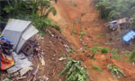
This is the worst natural disaster since the tsunami in 1994 that killed over 38,000 people along the coastal belt of Sri Lanka.In this article, I will attempt to identify the various i nstitutions charged with responding t o such natural disasters and further strengthening of effective coordination between these institutions and the management of the estates. The reports indicate that the Disaster Management Centre together with the National Building Research Organisation (NBRO) had warned the estates in the areas now effected to evacuate the people form 2012 and take remedial measures to stabilize the steep slopes to prevent such instability under the guidance and direction of the NBRO, which is charged with research on slope stability and other related subjects. The District Secretary of the area was also informed about this matter but no action had been taken by those responsible as reported in the media.
PAST HISTORY O FLAND SLIDES AND RISK OF DISASTERS
The Sri Lanka National Report on Disaster Risk, Poverty and Human Relationship covering the period 1974 to 2008 is an excellent document presumably prepared by the Disaster Management Ministry with t he other government agencies as well as experts from the universities and I must commend that it has some very relevant past information and data to plan out an effective national disaster management plan for landslides, which would be indispensable in prediction and mitigation of such disasters.
The landslides up to 2002 were considered as minor disasters and from 1974 to 2002 the incidence was 10 to 60 per annum. However, in 2006, this shot up to nearly 360. The seasonal distributions were during the south west and north east monsoons and the months were January, May and October that experience the highest rainfall.
However, the data studied from the report clearly indicates that there had been a sudden increase in landslides from 2003 to 2008 and continued up to now, culminating in the recent disaster and will continue unabated if no effective national plan is formulated and implemented immediately. The spatial distribution of landslides mainly occurs in the Badulla, Nuwara Eliya and Kegalle Districts. The reasons for such an increase have to be studied and remedial measures taken at a national level to prevent such disasters in the future.
It is also noted that the deaths due to landslides are less than the number of people affected with two exceptions i n 1989 and 2003, where 225 and 150 people died, i ndicating the recent catastrophe of deaths t hat exceed t he earlier figures the highest recorded since 1974 or beyond.
KEY FACTORS TRIGGERING LANDSLIDES
In general, landslides occur in slopes with gradients of over 30 degrees in lands that are unstable by clearing for various cultivations specially tea, homestead gardens, etc., with bad land use practices, including soil management. With the unstable slopes and the disturbed soil cover, water seeps in through the rock and the top soil lubricating it and triggering the slide resulting in mass movement of lose earth with mud and other debris.
The other cause is the non-maintenance of contour drains, especially in the estates, as well as blocking of natural water courses that are common in steep areas, which are sometimes subject to illicit gemming and diversion of water for vegetable plots and domestic use, etc.
INSTITUTION SDEALING WITH MONITORING ANDMITIGATIONOFLANDSLIDES
The Geological Survey Department (present GSMB) was the key government institution since 1950 for monitoring landslides and carrying out periodic field inspections focusing t he hill country in close coordination with the Soil Conversation Unit, under the Irrigation Department.
The old files of the Geological Survey gives technical details of all the past landslides in Sri Lanka and each occurrence was investigated in detail comparing the slope stability with the rainfall data from the Hydrometeorology of Ceylon, a comprehensive report of the rainfall figures from 1907 t o 1956 for the whole island, as well as up to 1962, covering special river basins (Hydrometeorology of Ceylon, a Colombo Plan Project undertaken by Hunting Survey Corporation of Canada 1958).
These studies revealed whether the landslides were caused by excess precipitation combined with other factors related to slope stability due to unsustainable land use, etc. A Professional Paper on landslides in the Kothmale valley, especially in Kadadora, by Geological Survey Deputy Director, the late Herman Sirimanne, in close coordination with the Soil Conversation Department in the 1950s, was a valuable source of information when the Kothmale reservoir and dam were constructed in the 1980s under the Mahaweli Project, as the report identified the areas that have to be stabilized to prevent any slides after the reservoir was flooded.
A map was prepared by me in the 1980s when I was a geologist in the Geological Survey, showing all t he l ocations of landslides from the old files and concluded that such slides were also spreading to the southern and south western parts of the country attributed to bad land use without any supervision or guidance by the Soil Conservation Officers.
I am not aware whether these files are preserved at the present GSMB and if available, is a valuable guide for future studies.The NBRO was established in 1984 as the focal point for all landslide-related studies and services in Sri Lanka. It functions as the research arm of the Ministry of Disaster Management (MDM) with a new mandate apart from its capabilities in geotechnical investigations at proposed building sites, research on building materials, etc., and functions under this ministry after the promulgation of the Sri Lanka Disaster Management Act No.13 of 2005. The Meteorology Department was also placed under the new ministry for effective coordination, especially on landslides, as rainfall plays an undisputed role in such natural disasters.
Further, the National Policy on Disaster Management of Sri Lanka of the MDM, established in 2005 under the Sri Lanka Disaster Management Act No 13 of 2005, provides for the coordination at the highest level establishment of the institutional framework, including the National Council for Disaster Management (NCDM) chaired by the president, Disaster Management Centre (DMC) and establishes the powers and functions of the institution. The act also recognizes the cross–cutting nature of disaster management and empowers the president to declare a state of disaster, covering a specific area of the country.
CONCLUSIONS AND RECOMMENDATIONS
The present institutional structure of the DMC, under the MDM, does not include the close coordination of the GSMB, the successor to the Geological Survey Department, the only government institution t hat carried out detailed research on landslides from early 1950s and the geologists of the GSMB are not called upon to carry out joint investigations on landslides.
Further, the students of the Peradeniya University, Geology Department, together with other universities, under the guidance and leadership of Professor Emeritus Kapila Dahanayake, who has written a book for laymen on how to cope with landslides, has done considerable research on recognition, prediction and mitigation of landslides in Sri Lanka
.
The Geological Survey Department in late 1960s carried out a detailed investigation on the Beragala landslide close to Haputale that killed a number of people. It concluded that bad management of a tea estate above the steep scarp was responsible for this landslide due to not maintaining contour drains at the higher elevation and bad land use. A similar slide was investigated in detail by me in the Nawalapitiya area in the 1980s, where again was attributed to the same reasons.
It was recognized from the 1980s or before by the Geological Survey that the entire Haputale scarp, i ncluding the present slip area in Haldumulla and Koslanda, Kalupahana as well as the Poonagala valley up to Ella, is unstable and this extensive area is vulnerable to landslides.It is recommended that a Presidential Task Force be appointed immediately to include all the relevant institutions and the GSMB, as well as the universities, together with Professor Kapila Dahanayake as a senior consultant, charged with carrying out detailed mapping of this large area and identifying vulnerable sites that could be prone to landslides, with recommendations for mitigation.
Further, the Meteorology Department should continue to compile all records of rainfall from 1962, covering the hill country and conclude whether there is any correlation with the changing patterns of rainfall and its impact on landslides, as Sri Lanka, which now evidences excessive periods of drought followed by excessive rainfall - an indication of climate change.
It is strongly urged that this task should be undertaken without delay if we are to stabilize the vulnerable areas and prevent any further natural disasters as observed this week. To assist the research team, the landslide hazard maps prepared by a team from the UNDP in close coordination with the NBRO in the late 1980s, will be indispensable. The experts in remote sensing will be invaluable for this task, as it is a large area.
However, it must be stressed that any national plan to identify landslide-prone areas and carry out effective mitigation close cooperation of the other government officials, including district secretaries as well as Members of Parliament and Provincial Councils, etc., needed and suggest that this entire project to come under the president, realizing its national importance and the i mportance of meaningful and effective coordination.
(Dulip Jayawardena, a retired Economic Affairs Officer United Nations ESCAP and Director of the Geological Survey Department from 1985 to 1987
with nearly 50 years’ experience as a professional earth scientist, can bereached at fasttrack@eol.lk)
Nihal Ferdinando Friday, 07 November 2014 08:59 PM
Rock tunneling as in Upper Kotmale Project may have an impact on landslide occurrence.

Add comment
Comments will be edited (grammar, spelling and slang) and authorized at the discretion of Daily Mirror online. The website also has the right not to publish selected comments.
Reply To:
Name - Reply Comment

US authorities are currently reviewing the manifest of every cargo aboard MV

On March 26, a couple arriving from Thailand was arrested with 88 live animal

According to villagers from Naula-Moragolla out of 105 families 80 can afford

Is the situation in Sri Lanka so grim that locals harbour hope that they coul